Data Sets » Format: map serviceRemove Facet » All Fields: environmental indicatorsRemove Facet
1 of 1
Prev | Next

VIIRS Plus DMSP Change in Lights (VIIRS+DMSP dLIGHT), v1 (1992, 2002, 2013)

Satellite-Derived Environmental Indicators

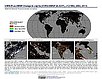
To visualize changes in brightness and extent of global nighttime lights networks over two decades with improved radiometric accuracy and finer spatial resolution.

Environmental Performance Index, 2020 Release (1950 – 2020)

Environmental Performance Index (EPI)

To provide quantitative metrics for evaluating a country's environmental performance in different policy categories relative to clearly defined targets.

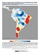
Trends in Global Freshwater Availability from the Gravity Recovery and Climate Experiment (GRACE), v1 (2002 – 2016)

Satellite-Derived Environmental Indicators

To provide data on changes in freshwater availability in order to better understand impacts on regional food supplies, human and ecosystem health, energy generation, and social unrest.

Environmental Performance Index, 2018 Release (1950 – 2018)

Environmental Performance Index (EPI)

To provide quantitative metrics for evaluating a country's environmental performance in different policy categories relative to clearly defined targets.

Global 3-Year Running Mean Ground-Level NO2 Grids from GOME, SCIAMACHY and GOME-2, v1 (1996 – 2012)

Satellite-Derived Environmental Indicators

To provide a continuous surface of NO2 concentrations for health and environmental research.

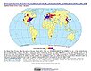
Natural Resource Protection and Child Health Indicators, 2017 Release (2010 – 2016)

Natural Resource Management Index (NRMI)

To assist in the country selection process for the Millennium Challenge Corporation (MCC) by providing indicators of natural resource protection and child health that complement the governance, social, and economic indicators used by MCC as country selection criteria.

Global Urban Heat Island (UHI) Data Set, v1 (2013)

Satellite-Derived Environmental Indicators

To provide a global data set of average summer daytime maximum/nighttime minimum land surface temperatures (LSTs) for urban extents, as well as the LST difference between the urban area and the buffer.

Global Summer Land Surface Temperature (LST) Grids, v1 (2013)

Satellite-Derived Environmental Indicators

To provide raster representations of global summer daytime maximum and nighttime minimum surface temperature for studies related to human health and climate change.

Environmental Performance Index, 2016 Release (1950 – 2016)

Environmental Performance Index (EPI)

To provide quantitative metrics for evaluating a country's environmental performance in different policy categories relative to clearly defined targets.

Environmental Performance Index, 2014 Release (2002 – 2014)

Environmental Performance Index (EPI)

To provide quantitative metrics for evaluating a country's environmental performance in different policy categories relative to clearly defined targets.

Environmental Performance Index, 2010 Release (1994 – 2009)

Environmental Performance Index (EPI)

To provide quantitative metrics for evaluating a country's environmental performance in different policy categories relative to clearly defined targets.

Change in Chlorophyll-a Concentration, v1 (1998 – 2007)

Indicators of Coastal Water Quality

To provide tabular data on the trends of chlorophyll-a concentration on a pixel by pixel basis for identifying areas with improving, declining, and stable coastal water quality that can provide guidance for decision making in the context of coastal management.

Synthetic Assessment of Global Distribution of Vulnerability to Climate Change, v1 (2005, 2050, 2100)

Intergovernmental Panel on Climate Change

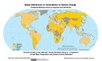
To provide geographical portraits of vulnerability designed to incorporate both exposure to climate change and national capacities to adapt.

Environmental Sustainability Index, 2005 Release (1980 – 2000)

Environmental Sustainability Index (ESI)

To create a comparative index of national-level environmental sustainability and to provide a mechanism for making environmental management more quantitative, empirically grounded and systematic.

Data Sets » Format: map serviceRemove Facet » All Fields: environmental indicatorsRemove Facet
1 of 1
Prev | Next